 New York Habitat is now providing a new version of maps for our website.
With apartment rentals in New York, Paris, London and the South of France it was essential to provide our customers the best tools possible.
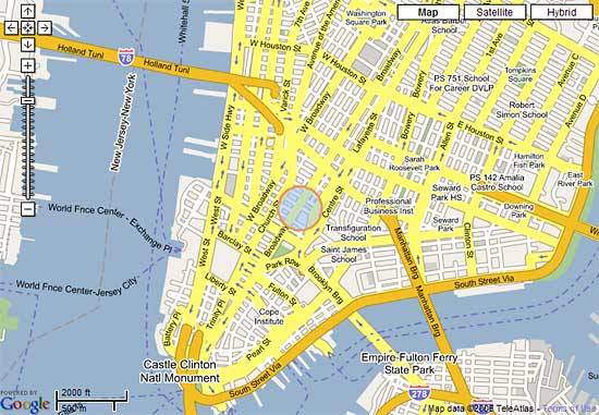
The new maps now have the following features, which we think you will enjoy:
Each map has three settings to view by clicking on the choices at the top right corner:
- Map: Which shows a standard street map
- Satellite: Which shows a satellite view of the streets
- Hybrid: A combined view of both the satellite and street maps
The maps can be zoomed in and out using the + and – buttons
By putting the mouse over the map and clicking on it you can move the position of the map to see surrounding areas.
In Paris and London, the subway stations are also included in the maps.
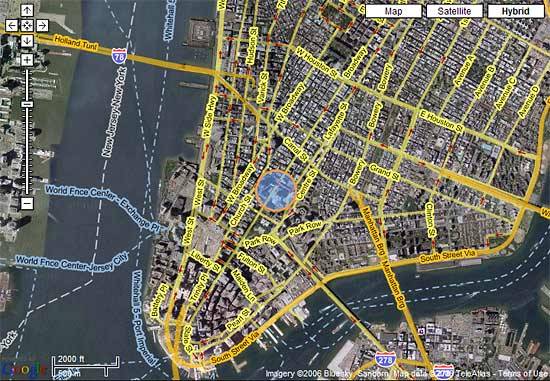 With the increased level of interactivity, these maps allow you to see more about the area the apartment is located in and a greater level of detail of streets that are nearby.
To provide security for the apartment owners we do not release the exact address of the apartment. Instead, we show a blue circle within which the apartment is located.
As always when looking for furnished accommodations, New York Habitat provided its owners and clients with the latest technological advancements all to make the job of fining a great furnished apartment that much easier.


Great maps…I use them all the time. I was wondering why the subways stations are not on your maps though?
Dear Bill,
Thanks for the comment. We have changed our mapping service a couple of months ago to offer better features with apartment searches. The subway stations are shown on Paris and London maps but not yet for the New York section.
We hope our map provider will be able to do so shortly.
Thank you again. Please don’t hesitate to comment on our website deatures.
Francois